
So, you need to define your property lines, but which type of land survey is right for you? Yes, there's more than one—seven, to be exact! Each one has a unique function and, more importantly, a different price tag. Picking the correct one is the first step to managing your budget effectively. We'll explain the different types of land surveys available. This will help you understand the factors that influence the final land survey cost and find the perfect fit for your project's needs.
Table of content
Can I Use a DIY Land Survey for Legal or Real Estate Purposes?
It’s important to understand that property sketches or maps you create yourself—no matter how precise—aren’t considered official documents. Mortgage lenders, title companies, and most government agencies require land surveys prepared and certified by a licensed professional. A DIY survey won’t capture critical legal details such as easements, rights-of-way, or possible overlaps that could affect ownership or future development. In short, land surveying is not a do-it-yourself job when it comes to legal transactions or protecting your property rights. For anything related to real estate sales, refinancing, or legal boundary questions, always invest in a certified land survey from a reputable, licensed surveyor.
What is land surveying?
Landing surveying is extremely technical and requires the surveyor to have extensive training and certifications. Each state has its licensing requirements and a set amount of experience needed to perform a survey. Surveyors use specialized tools to measure a plot. They collect data for every point of the land and check angles and distances. They then use a form of marker, like stakes, to mark the boundaries of a plot. Surveyors also perform a lot of research about land records.

Why Might I Need a Site Plan for My House?
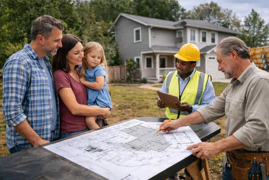
5 Reasons You Need Your Home’s Plot Plan
How much is a land survey?
The cost of a land survey in 2026 depends on several factors, including the size of your property, the type of survey you need, and how easily the surveyor can access property records. On average, homeowners can expect to pay anywhere from $475 for a small boundary survey to $25,000 or more for complex commercial or large undeveloped parcels. Most residential surveys will fall closer to the lower end of this range, but unique factors—like heavily wooded lots, irregular shapes, or missing documentation—can nudge the price higher. Always request a detailed estimate from your surveyor to avoid surprises.
According to Angi, land survey costs are as follows:
|
Survey type |
Average cost |
|
ALTA |
$2,500 - $10,000 |
|
Boundary |
$1,200 - $5,500 |
|
Topographic |
$2,000- $6,500 |
|
Mortgage |
$1,500- $4,500 |
|
Fence Land |
$1,000 - $3,200 |
|
New Construction |
$1,800 - $6,500 |
|
As-Built |
$1,600- $3,800 |
Why Your Price Expectation Might Be Outdated
If you’re budgeting for a professional property assessment, you might be in for a bit of sticker shock. Many homeowners hold onto a price expectation of around $300 to $500, but those figures are often decades old. The reality is that asking for the cost of this service is a bit like asking, "How long is a piece of string?" There's no single answer. The final price depends heavily on factors like your property's size and shape, the type of terrain, and how much research is needed to find historical property records. For many projects, it's wise to first determine if a detailed site plan for a permit can meet your needs, as it can be a more straightforward and affordable starting point.
Local Cost Examples
To give you a clearer picture of what to expect, it helps to look at real-world numbers. Costs for professional land assessments can change quite a bit from one city to another based on local market rates and demand. Below are a couple of examples from different parts of the country that show how much prices can vary. Keep in mind these are just snapshots, and your final quote will depend on the unique details of your property and project requirements. These examples should help you set a more realistic budget for the work you need done.
Spokane, Washington
In Spokane, Washington, the cost for a residential boundary determination is fairly moderate. For a typical property up to half an acre in size, homeowners can expect the average price to be around $600. The full price range for this kind of work generally falls between $400 and $800. This gives you a solid baseline for what a licensed professional might charge in the Pacific Northwest for establishing your property lines. The final cost will still depend on the complexity of your lot and the accessibility of its records.
Austin, Texas
Down in Austin, Texas, the pricing conversation gets a little more complex. While you might see some lower average costs mentioned online, it's important to understand what those prices include. Often, a lower price point may refer to a simpler mortgage report, which isn't the same as a detailed boundary assessment. For more in-depth work that clearly defines property lines for construction or disputes, the cost is typically higher. This highlights the importance of clarifying exactly what service you're getting before you agree to a price.
How much does an elevation certificate cost?
If you’re required to get an elevation certificate—often needed for flood insurance or property improvements—expect to pay between $150 and $600, with most homeowners seeing costs around $400. The price can swing up or down depending on your location, the complexity of your property’s terrain, and how accessible the site is for the surveyor.
Factors that can influence the cost include:
- Property size and layout: Larger or more challenging landscapes may require more time and specialized equipment.
- Local regulations: Some areas have stricter requirements, which can raise prices.
- Travel fees: If you’re far from a surveyor’s main office, travel surcharges may apply.
- Documentation or rush requests: Needing your certificate in a hurry—or with additional paperwork—can tack on extra charges.
Requesting quotes from multiple surveyors—using a service like Surveyor Pros—is a great way to compare and find the best rate for your area.
How can homeowners save money on land survey costs?
Land surveys aren't always cheap, but there are practical strategies to help keep your expenses in check. Here are a few cost-saving tips to consider before hiring a surveyor:
- Clarify your needs upfront: Before contacting professionals, determine exactly which type of survey is required for your property. This avoids paying for services or details you don’t really need.
- Ask for referrals and bundle services: If you’re already working with a real estate agent, contractor, or other specialist, inquire whether they can recommend a surveyor. Sometimes, referrals or bundled services come with a discount.
- Schedule during off-peak times: Surveyors are often busiest during warmer months. If your project allows, scheduling during the slower season might mean lower rates.
- Prepare your property: Clearing brush, marking boundaries, or removing obstacles beforehand can speed up the process, potentially reducing labor costs and avoiding extra charges.
By approaching the land survey process with a bit of planning, you’ll avoid overspending and still get the detailed results you need for your property decisions.
According to Angi, land survey costs are as follows:
Consider if a Site Plan Meets Your Needs
Before you commit to a costly and time-consuming process, it’s essential to figure out what kind of property document your project actually requires. For major legal or financial events like real estate closings, refinancing, or settling a boundary dispute, you’ll almost always need a formal document prepared by a licensed professional on-site. As Angi notes, mortgage lenders and title companies require these official documents because they legally define property lines. These services can be expensive, sometimes costing thousands of dollars, because they involve specialized equipment, historical record research, and fieldwork.
However, what if your needs are different? If you're a homeowner planning to build a deck, a contractor adding an extension, or a landscaper installing a pool, your primary goal is likely to get a permit. For these types of projects, your local building department or HOA typically just needs a clear, detailed drawing showing the property layout and the location of the proposed work. In these common scenarios, a professionally drafted site plan is often the perfect fit. It provides all the necessary information for your application without the high cost and long wait times, making it a practical and budget-friendly solution for your construction and renovation needs.
Timeline and project urgency
Another important factor affecting the cost of a land survey is how quickly you need the job completed. If you’re on a tight deadline or request a survey at the last minute, expect to pay more. That’s because surveying isn’t a “drop everything and rush over” industry—each job requires careful research, planning, and coordination.
Surveyors may need to rearrange their schedules, put other projects on hold, or work outside of normal hours to deliver quick results. All this extra effort and overtime increases the overall cost of your survey. If possible, try to plan ahead and schedule your survey in advance to avoid extra rush fees.
Land survey costs by type
Land survey costs vary based on the type of land survey performed, ranging between $100 and $3,000. Whether you are trying to locate your property lines or split different land parcels, professional surveyors can meet your needs.
For a quote on a specific property we have found Surveyor Pros Nationwide Quoting and Scheduling system to be helpful.
According to Angi, land survey costs are as follows:
Survey type Average cost ALTA $1,200 - $3,000 Boundary $100 - $600 Location $600 - $1,000 Subdivision $300 - $1,000 Site-Planning $1,000 Construction $1,000 - $2,000 Topographic $500 - $1,200 Land survey costs by type.
The nationwide average cost of a land survey is around $500, but this can be much higher depending on what city and state the property is located in, along with the size of the lot and type of survey that you need to be performed.
ALTA land survey costs
An American Land Title Association (ALTA) land survey — also known as a mortgage survey — costs between $2,500and $10,000.
This type of survey is typically performed when you are buying an investment property or a home. They are often required by a title company or lender before your property can be approved for financing.
ALTA surveys are among the most comprehensive, conducted to specific standards set by the American Land Title Association. They are often used for commercial properties or in cases of title disputes, and due to their thoroughness, can sometimes cost as much as $10,000 in particularly complex cases.
Boundary survey costs
Boundary surveys determine the exact boundaries and corners of a property. They are generally used for personal records, local easements, or to settle a legal dispute. They cost between $1,200and $5,500.
Use case example:
If you’re about to build a fence, or want to confirm your home’s exact limits, a boundary survey is your go-to. For larger or irregularly shaped lots, expect costs near the higher end of the range.
Boundary adjustments and their impact on survey costs
A boundary adjustment occurs when the official property lines between two parcels are modified. This might be needed if neighbors agree to exchange small sections of land, or when correcting previous surveying errors. Because changing a boundary line is a legal process, it requires involvement from both property owners and approval from the local municipality.
When undertaking a boundary adjustment, keep in mind that both parcels must be surveyed—a step that adds to the overall cost. The surveyor will need to prepare new maps and formal documentation to be submitted for municipal approval. As a result, the total expense for a boundary adjustment is typically higher than a standard boundary survey, since it involves extra surveying work and paperwork for both properties.
Location survey
Location surveys are similar to the boundary survey, but they also include site improvements. They show the size and location of improvements and measurements of the distance between them and the property lines. They are often performed when obtaining zoning permits. This type of land survey costs between $600 and $1,000.
Subdivision survey
Subdivision surveys costs around $500 on average. They come in handy when dividing parcels of land into multiple lots. They are used to create subdivision plats and have to get filed in the land records.
Plat survey
A plat survey, sometimes referred to as a plat map, is an official survey that documents the layout and boundaries of a parcel of land. This type of survey produces a detailed map showing property lines, easements, streets, and notable land features such as trees or large rocks. Most properties already have a recorded plat map that is referenced in property deeds and legal documents. In addition to the map, a plat survey provides a written legal description of the property. The process and cost are usually similar to a boundary survey, serving as a vital reference when determining or clarifying property boundaries.
Site-planning survey
Site-planning surveys are used to plan site improvement development. These are also necessary when applying for building permits, and the proposed improvement is drawn inside the survey boundary. This type of land survey costs $1,000 on average.
Construction survey
A construction survey usually costs between $1,800 and $6,500 and shows workers the distances between planned improvements and where to build. Construction surveyors will mark out the location where structures will be built.
New Construction Surveys
For major projects, a new construction survey may combine several survey types—boundary, staking, and topographical. These comprehensive surveys can cost from $1,800 up to $6,500, depending on the project’s size and complexity.
Topographic survey
Topographical surveys show the location of human-made and natural features on a lot. They are used to plan site improvements and include locations of things like fences, trees, utilities, and elevations. This type of land survey costs between $2,000 and $6,500.
Staking survey
A staking survey is commonly required for new construction projects. In this type of survey, a professional surveyor physically marks property corners and outlines where specific features—like buildings, driveways, or sidewalks—will be placed on the lot. The complexity and cost of a staking survey depend on how many elements need to be marked out, since each additional feature increases the surveyor’s workload and time on site. Staking surveys are essential for ensuring construction happens within the proper boundaries, avoiding costly mistakes with property lines or municipal setbacks.
As-built survey
An as-built survey is used to capture a precise record of everything that currently exists on your property after construction or major renovations are complete. This type of survey maps all existing structures, walls, utility lines, and boundaries as they actually appear on the land—not just as they were originally planned.
Surveyors take highly accurate measurements to ensure the as-built drawings or models reflect the true placement and dimensions of site features. As-built surveys are especially useful for confirming that completed work matches design plans, documenting changes, or resolving potential disputes related to property improvements.
Whether you're wrapping up a home remodel, adding a new addition, or verifying compliance for permitting, an as-built survey gives you detailed documentation of the property as it stands.
Why choose a topographic survey?
If your land has rolling hills, streams, or mature trees, a topographic survey will help you (and your landscape architect) plan around these features. This survey is particularly helpful for rural or uneven properties and is often a prerequisite for new construction.
Other specialized survey types:
- Mortgage survey: Similar to boundary surveys but specifically required by lenders during the home financing process. Typical costs run from $1,500–$4,500.
- Fence land survey: Needed for accurately placing fences, usually between $1,000–$3,200.
- As-built survey: Used after construction to confirm that work matches the original plans, with costs ranging from $1,600–$3,800.
As you can see, the price of a land survey depends greatly on the type you need, the level of detail required, and the unique features of your property. Always clarify what’s included in your surveyor’s pricing and which type best suits your project before getting started.
Site preparation: costs and key factors
Site preparation is a crucial first step in any construction or development project, but the costs can vary widely based on the specific needs of your site. On average, homeowners can expect site preparation expenses to fall anywhere from $1,200 to $4,500, but projects with extensive grading, clearing, or demolition can run higher.
A few key factors that influence the total cost:
- Size of the property – Larger lots require more machinery, labor, and time, driving costs higher.
- Terrain and soil conditions – Heavily wooded areas, rocky soils, or lots with uneven grades are more challenging to work on and will increase your expenses. Clearing trees, removing stumps, or tackling steep slopes requires specialized equipment.
- Access to the site – If your property is hard to reach or requires the creation of a temporary access road, this will add to the total.
- Demolition and debris removal – Knocking down existing structures or hauling away debris comes with its own price tag.
- Required permits and inspections – Local regulations may call for permits or soil testing before work can begin, which can add both time and costs.
- Utilities and drainage work – Installing or relocating water, sewer, or electric lines, or improving drainage, can increase your total cost.
For the most accurate site preparation estimate, it’s best to consult with a local site contractor who can assess your unique property conditions and requirements. Getting a few competing bids and checking references will help you plan and budget effectively for your project.
Land survey costs explained
How much land surveys cost depends largely on the type of survey, size and shape of the property, and how much travel is involved for the surveyor.
Factors that dictate the cost of a land survey include:
- Acreage – The acreage of a property is one of the most significant factors in pricing a land survey. When having a lot surveyed over a couple of acres, the price can easily reach into the thousands.
- Terrain – Clear and flat areas are typically much less expensive to survey than land with lots of hills and vegetation. The more complicated the terrain is, the more a surveyor will charge.
- Type of survey – Different types of land surveys have vastly different costs. ALTA and new construction surveys are generally the most expensive, while property, boundary, and mortgage surveys are usually the least costly.
- Travel and research – A professional surveyor will research a property’s deeds and official records to compare them with the lot’s walls and fences. The farther that a surveyor has to travel to reach the location, the more you will have to pay for their time.
Age of the Property
The age of your property can play a surprising role in the final cost of defining its boundaries. Older parcels of land are often more complex to assess because the original markers mentioned in historical deeds—like a specific tree, a large rock, or an old fence—may have disappeared or shifted over time. This means a professional may need to conduct more in-depth historical research to piece together the property's history. When documentation is missing or records are conflicting, which is more common with older properties, the time and effort required to produce a detailed report increases. If you know your property has a long history, gathering any old deeds or plans you have can be a helpful first step before contacting a professional.
Tips to Save on Land Survey Costs
While it’s necessary to hire a professional for land surveying, there are a few ways you can help keep costs in check:
- Ask for referrals. If you’re working with a realtor, they may know reputable surveyors and could even help you get a better rate.
- Prepare documentation. Gather any existing surveys, deeds, or property documents you have, and share them with your surveyor upfront. The more information you provide, the less time they’ll spend on research.
- Clear the property. Remove any debris, brush, or temporary obstacles that could slow down the survey process. Easier access can mean a quicker, less costly job.
- Compare quotes. Get estimates from multiple surveying companies. Be sure to ask about research and travel charges, which can vary.
- Consider recertification. If you have a previous survey and nothing has changed, ask if it’s possible to recertify the existing documents instead of starting from scratch. Recertification can cost up to 50% less than a new survey.
- Plan for timing. Some surveyors offer lower rates during their off-peak seasons. Check with local companies about the least expensive time of year for a survey.
By understanding what affects pricing and taking a few proactive steps, you can help make your land survey more affordable and efficient.
Cost by property size
Surveyors may charge based on acreage or by square footage, depending on the size and complexity of the job. For smaller lots—often a half-acre or less—there’s usually a flat fee, while larger parcels are billed per acre. Typically, you can expect to pay anywhere from $50 to $500 per acre or $0.15 to $0.70 per square foot, depending on your region and the specifics of the property. The rate per acre usually decreases as the property size increases, so although the total cost rises for larger parcels, you’ll pay less per acre for a bigger survey.
Here’s a look at average costs by acreage:
Acreage Average Cost One-half $200–$700 1–2 $500–$1,000 5 $1,500–$2,000 10 $2,000–$2,500 40 $3,000–$6,000 Larger properties require more time, more survey markers, and more legwork, all of which add to the total.
Ultimately, the total you’ll pay will depend on a blend of these factors, so it’s always wise to get a detailed quote from a licensed local surveyor before moving forward.
Land clearing costs and what affects them
How much it costs to clear land can vary quite a bit. In most cases, you’ll pay anywhere from $1,200 to $6,000 for a typical residential lot, but the total can swing much higher depending on the property size, density of growth, accessibility, and other unique site factors.
Several key elements play into these costs:
- Size of the lot – Larger lots naturally require more labor and equipment, which leads to higher overall costs.
- Type and density of vegetation – Clearing thick woods with mature trees and stubborn underbrush is much more involved (and pricey) than tackling a lot with only grass or sparse small trees and shrubs.
- Topography – Level ground is typically easier (and cheaper) to clear than steep slopes, rocky terrain, or wet lowlands.
- Debris removal – Hauling away felled trees, stumps, or rocks, or chipping and disposing of the debris, will add to your final bill.
- Permitting and local regulations – Some municipalities require land clearing permits or special considerations for protected species, which can affect both cost and timing.
- Accessibility – If your plot is hard to reach or heavy equipment can’t get close, clearing can take longer and cost more.
If you’ve got your eye on a heavily wooded or overgrown lot, be prepared for costs at the higher end of the scale—especially if you need stumps or large rocks removed, or if your site requires extra grading after clearing. Always check what your municipality requires in terms of permits or erosion control as you budget for this step.
How referrals and timing can help you save
If you’re looking to trim the cost of your land survey, a few strategic moves can make a real difference.
-
Leverage referrals. Working with a realtor or contractor you trust? Ask if they know a reputable surveyor. Not only can a good referral save you time hunting for the right pro, but many surveyors offer a discount when you’re introduced by an industry colleague.
-
Consider the timing. Surveyors go through busy and slow periods, just like any other profession. If your schedule allows, ask when their off-peak season falls—often during winter or rainy months in many regions. Scheduling your survey during these slower times can sometimes mean lower rates or added flexibility.
By being flexible with your timing and tapping into your network for trusted recommendations, you’re more likely to land a quality survey at a fair price.
Do surveyors charge extra for documentation or special maps?
Yes, you can expect to pay additional fees if you need special documentation or custom maps prepared by your surveyor. For example, if you ask for detailed reports, extra copies, or special presentations—such as having the surveyor attend a zoning board meeting or provide testimony—these services are typically billed separately at an hourly consulting rate or as a flat fee. Make sure to clarify your documentation needs upfront and discuss any extra costs associated with preparing specialized materials, so you’re not caught off guard when you receive the final invoice.
Common add-on costs after a land survey
After completing a land survey, many property owners move forward with other improvement projects—each carrying its own set of price tags. Surveying simply sets the stage for work like fencing, building, and landscaping. Here’s what you can expect if you decide to tackle common post-survey upgrades:
- Fencing: Putting up a new fence along the freshly marked boundary lines will typically cost between $8 and $50 per linear foot, depending on materials and design.
- Stone wall construction: For those who favor a classic stone wall, expect to spend somewhere between $2,250 and $7,800, with variations based on the size and type of stone used.
- Shed installation: Adding a shed for tools or storage can cost anywhere from $350 for basic prefab units, up to $4,000 or more for larger or custom options.
- Landscaping improvements: Landscaping design services usually run in the range of $2,000 to $7,000, influenced by the scale of the project and your specific vision.
These costs are in addition to the survey fee, and it’s wise to budget for them if you anticipate making any improvements once the boundaries are confirmed.
Does the time of year impact land survey costs?
Yes, the time of year can play a role in how much you pay for a land survey. Challenging weather conditions—think: dense summer foliage, icy winter terrain, or heavy spring rains—can slow down a surveyor’s work and make the job more complex.
When temperatures drop and snow covers the ground, survey markers and boundary lines can be obscured, leading to extra work and higher charges. Similarly, dense vegetation in late spring or summer can force surveyors to spend additional time clearing paths to take accurate measurements.
If you’re scheduling a survey and looking to save, consider booking during mild weather months when the land is easiest to access. This can help streamline the process and keep costs down.
What to share with your surveyor
If you want to keep costs down—and make sure your surveyor’s work is as accurate as possible—it helps to come prepared. Start by gathering any old property deeds, maps, prior survey documents, and records of boundary adjustments you might have stashed away. The more background you can provide, the less time your surveyor will spend digging through public archives (and billing you for the privilege).
Other helpful info includes:
- Details about any known disputes or past changes to fences, driveways, or easements
- Copies of subdivision plats or legal descriptions from when the property was bought or sold
- Information on recent improvements or construction
Not only will this speed up the process, but it can also help avoid errors that might sneak in if a surveyor is working with incomplete information. Even small details—like that garden shed your uncle put up in the '80s—may impact your results.
Parcel information and property records
The availability of property records is another factor that can influence what you’ll pay for a land survey. Surveyors often depend on local deed records and parcel information to complete their work efficiently. If those documents are easily accessible—say, available online or through well-organized county offices—your survey will likely move along more smoothly, saving both time and money.
However, if key records are missing, hard to find, or require in-person retrieval from busy government offices, additional hours may be needed for research and investigation. Surveyors typically charge extra for this legwork. You can avoid some of these charges by gathering any needed deeds, plats, or previous surveys from the county or city records office yourself before hiring the surveyor. A little prep work on your end can help keep your survey costs in check.
Labor rates and survey crew size
Labor rates and the size of the crew handling your survey can also play a major role in the final price. Most surveyors charge by the hour, and rates typically range from $220 to $450, depending on how many people are required and the complexity of the project.
In general:
- Smaller surveys (like a simple boundary check) may only need one or two surveyors on-site, keeping your costs at the lower end of the range.
- Larger or more complicated jobs—such as surveying large tracts of land or lots with challenging terrain—often require a bigger crew and more hours, which quickly adds to the total bill.
If your land has unusual features or requires extra manpower, expect the survey’s overall cost to increase accordingly. The more hands (and expertise) needed, the more the price goes up.
Tips for Saving Money on Your Land Survey
While hiring a licensed surveyor is a necessary investment, there are a few practical steps you can take to help keep your costs in check:
- Ask for referrals – If you’re working with a real estate agent or builder, see if they can recommend a local surveyor they trust. Sometimes those relationships can mean better pricing or priority scheduling.
- Be organized with records – Gather up any previous surveys, deeds, plats, or other property records you have. Providing these documents in advance can significantly reduce the amount of research the surveyor has to do—saving both time and money.
- Communicate clearly with your surveyor – The more information you can share about your property and what you need, the smoother the process will be. Make sure to outline special concerns or unusual lot features early on.
- Schedule wisely – Some surveyors offer reduced rates during slower seasons. Consider asking about potential off-peak scheduling if your timeline is flexible.
- See if recertification is an option – In some cases, an existing survey can be updated for a lower fee rather than commissioning an entirely new survey. This can sometimes save you up to half the typical cost.
- Clear obstacles ahead of time – Clearing away brush, debris, or any barriers along boundary lines will make your property easier (and faster) to survey.
- Compare multiple quotes – Get estimates from several experienced local surveyors, but keep in mind their rates might include travel or extra research if your property is further out.
Taking a little time to prepare can help you avoid unnecessary expenses and ensure you get an accurate, timely survey done right the first time.
How seasonal conditions affect land survey costs
The time of year when you schedule a land survey can make a real difference to both the process and the price. Harsh winter weather can slow things down—snow and ice tend to cover up important markers or make the property hard to access, driving up labor time and, ultimately, your final bill. On the other hand, dense foliage in the summer can also complicate a survey, especially in heavily wooded lots where thick leaves block sight lines.
For properties with a lot of trees, early spring or late autumn is often the best window. Without all the leaves on the branches, surveyors can more easily spot boundaries and landmarks, finishing the job faster and perhaps at a lower cost. If you’re looking to save, try to avoid scheduling surveys during the extremes—whether it's deep winter or the height of the growing season—since easier conditions make for a quicker and cheaper survey.
Can previous survey documents or plat maps reduce the cost of a land survey?
Having access to existing survey documents, plat maps, or plot plans can make a significant difference in the overall cost of your land survey. When these records are available and up to date, your surveyor can use them as a starting point rather than beginning the surveying process from scratch. This often results in less time spent on research and measurement, reducing both the scope of work and the final price.
You can usually obtain previous survey records and plat maps from your local tax assessor’s office or land records department. However, if your property is older and hasn’t been surveyed in a long time, there’s a possibility that detailed documents could be missing or outdated. In those cases, your surveyor may still need to perform a more comprehensive survey, potentially increasing the cost.
Providing as much documentation as possible will always work in your favor—streamlining the surveying process and possibly keeping more money in your pocket.
How time constraints affect survey cost and timing
When it comes to scheduling a land survey, time is an important factor that can impact both the cost and duration. Standard residential surveys often require about five to ten days for completion, as surveyors need time to review records, research old property lines if needed, and take all necessary measurements. For more involved properties—think large acreage, commercial sites, or ALTA surveys—the process can stretch up to three weeks, especially if the documentation is inconsistent or missing altogether.
If you're in a hurry and need a rush survey, be prepared to pay extra. Expedited jobs are possible, sometimes wrapping up in as little as two to five days, but this service comes with a premium price tag. That's because surveyors must rearrange their schedules, possibly dedicate additional crews, and work overtime. For most people, planning ahead will help keep both your timeline and your costs under control.
How the availability of information impacts the price
One often-overlooked factor in land survey costs is how much information is already available about your property. When a surveyor has easy access to recent plats, plot plans, or prior survey documents—often found at the local tax assessor’s office—the job goes more smoothly and can cost less. If your property has comprehensive, up-to-date records, the surveyor can use these as a starting point, saving both time and money.
However, for older properties or those that haven’t been surveyed in decades, records may be incomplete or missing altogether. In these cases, the surveyor may need to perform additional research or start the process from scratch, which increases both the complexity and the total cost of the survey.
Having all relevant paperwork handy before you call a surveyor can help keep costs down while ensuring a more accurate result.
How to Do Your Own Property Research (For Informational Use Only)
If you're curious about your property's layout, you can do some preliminary research on your own. This process can help you get a general sense of your land's dimensions and features before starting a project. However, it's crucial to remember that this type of DIY research is for your personal information only. It is not a substitute for the official documents required by permitting offices or for legal purposes. When you need a drawing for a permit application, you'll need a professionally drafted site plan that meets local requirements. Think of this as your initial homework to become more familiar with your property.
Step 1: Understand Your Property's Deed
Your property's deed is the best place to start. This legal document not only proves ownership but also contains a "legal description" of your land. This description is the key to understanding its boundaries. It’s not just an address; it’s a specific, detailed outline of the property's size and shape. Finding and reading this section will give you the foundational information you need to locate your property lines. There are two common systems used to describe land, and your deed will likely use one of them to define your property’s specific location and dimensions.
Metes and Bounds vs. Public Land Survey System
When you look for the legal description, you'll likely encounter one of two methods. The "Metes and Bounds" system is common in the original 13 colonies and describes property lines using natural features, landmarks, and distances—for example, "from the old oak tree, 100 feet north to the stone wall." The other method is the Public Land Survey System (PLSS), which divides land into a grid of townships and sections. This system is more common in the rest of the country and provides a more standardized, grid-based description. Understanding which system your deed uses will help you interpret the information correctly.
Step 2: Prepare for Your Search
Before you head outside, gather all the property-related documents you can find. This includes your deed, any previous plot plans, and title insurance paperwork. Having these documents on hand provides a more complete picture and can save a lot of time. According to Angi, providing as much information as you can upfront is always a good practice. If your end goal is a home improvement project that requires a permit, collecting these documents is a great first step. It will streamline the process when you're ready to order a detailed site plan, ensuring all existing information is accounted for.
Step 3: Find Your Property Markers
With your deed in hand, you can start looking for physical property markers. These are often metal pins, pipes, or concrete monuments set at the corners of your property. Your deed or an old plat map might even describe what kind of marker to look for. These markers were placed there for a reason—to physically represent the corners outlined in your legal description. You may need a metal detector to find them, as they can become buried over time. Locating these markers can give you a tangible reference for where your property lines begin and end.
Important: Never Move a Boundary Marker
This is a critical rule: if you find a property marker, do not move it. These markers are only legally valid if they remain in their original, professionally placed location. As Mother Earth News points out, only a licensed professional is legally allowed to move or establish new boundary lines. Tampering with a marker can create serious legal disputes with neighbors and complicate future property transactions or building projects. If you believe a marker is in the wrong place or is missing, the correct course of action is to consult with a professional who is licensed to handle such matters.
Who needs land surveying?
Most people use a land survey when buying or selling land, or to prepare for a building project. It is crucial even for projects as small as building a new fence; you wouldn’t want to accidentally build on a neighbor’s land and have to redo your whole project from scratch. It is equally vital when closing on a real estate deal; a mortgage survey verifies what is actually on a property.
By having a professional examine and document your property, you can prevent future problems from arising about your boundaries.
Those buying or selling a house
When buying and selling property, it's important to have all property lines clearly established. This ensures that new owners have clear documentation of the land they own and its exact beginning and end locations.
Those expanding
Additions usually expand the house physically, and you can’t build an expansion that protrudes over into the neighbor's yard. You also need to pay attention to the property lines when you make landscaping renovations.
Those installing a fence
Fences go up around a property to enhance the appearance and increase security/privacy. Naturally, you want the fence to go up at your exact property lines to avoid any problems with the neighbors.
Those dividing land
In the case where you need to divide the land, you also want to know the exact boundaries so you know exactly how much land goes to each person. This can eventually help calculate each person’s share in the case of a sale after a death or funeral.
For commercial purposes
When you buy a commercial property, knowing your boundary lines can ensure that you don’t run into a problem with the neighbors around you, especially as your business expands.
How do I get a land survey for my property?
Like any home improvement project, you shouldn’t choose a professional based solely on their prices. You always want a reputable surveyor performing the work if the property lines are ever disputed in a courtroom. A survey from a reliable professional is typically valid for five to ten years.
To make the process go as smoothly as possible, keep a few things in mind:
- Be clear about your needs: Explain why you want the survey—whether it's for building, selling, boundary clarification, or something else. The type of survey you need can impact both costs and timelines.
- Gather your paperwork: Provide your surveyor with as much historical information as you can, such as old deeds, previous surveys, or property descriptions. This helps them get a complete picture of your land.
- Ensure impartiality: If the survey is for a real estate transaction, double-check that your chosen surveyor has no connections to the other party involved in the sale.
- Prepare your property: Ask your surveyor if you need to prep the land ahead of time. This could mean clearing any debris or making sure they have access to all corners of the lot.
By following these steps and hiring a trustworthy professional, you’ll ensure your land survey is accurate and legally sound—saving you potential headaches down the road.
What questions should you ask when getting an estimate from a land surveyor?
When you're collecting estimates, it's smart to dig a little deeper than just the bottom line. Here are some important questions to ask:
- How many people will be working on my survey, and what is their experience level? Seasoned surveyors may complete the job more efficiently and accurately.
- Are there additional travel fees if my property is outside your usual service area?
- Do you offer any seasonal rates or discounts during less busy times of year?
- What other factors might impact the total cost of my survey?
- Can you give a detailed breakdown of what's included in your estimate?
Getting clear answers to these questions will help you feel confident you're hiring the right professional for the job—and that there won't be any costly surprises down the road.
Get Quotes Directly from Professionals
When you need to officially determine your property's boundaries, don’t settle on the first quote you get. The cost for this specialized work can vary widely between firms, so collecting several estimates is the best way to ensure you're getting a fair price. Factors like your property's size, the complexity of the terrain, and the specific type of work you need all play a role in the final cost. To get a clear picture of what you might pay, you should request quotes from multiple local professionals.
To make the comparison process easier and avoid surprises, always ask for a detailed, itemized estimate that breaks down all costs, from labor and travel to research fees. You can also help keep costs down by being prepared. Gather any existing property documents you have, such as old deeds, plat maps, or records of previous boundary work. Providing this information upfront can reduce the amount of research the professional needs to do, which can save you both time and money on the final bill.
What does a land survey look like?
Land surveys document the exact boundary of your property lines and what lies on your land. These boundaries are essential to show a bank what they are lending on, show construction crews where to build, and so you know where you can make improvements on your lot. Keep your land survey up to date with new features and enhancements so that it always maintains accuracy.
Here is everything included in a detailed land survey:
- Boundary lines – Your professional survey will provide you with a certified written report that clearly details your boundary lines, and you’ll also get a separate sealed certification you can use whenever you need to show proof of your boundary lines for the next 5 to 10 years, depending on the law in your specific state.
- Easements – The legal ability of someone to use someone else's land for a specific purpose.
- Rights-of-Way – The right of way when two pieces of land come together.
- Overlaps – Space where two people share the property due to an overlap in property lines.
- Service entrances – Places where service vehicles will enter the property.
- Underground utilities – Some surveys include details about water, sewer, and other utility lines beneath your property, which are crucial for safe construction.
When you receive your land survey, always ensure that the address on the report matches the address on your deed. One seemingly minuscule difference in the paperwork can have devastating effects. It’s also important to note that documents without a proof of certification from an authorized organization cannot be used for legal purposes and can slow down construction projects.
While MySitePlan doesn’t offer land surveys, we can provide you with a non-certified site plan, which might be all you need to get a building permit or to prevent boundary disputes. You can find out more about site plans here, or get in touch below to get started!
Why hire a professional land surveyor?
While the upfront cost may seem steep, there are important benefits to hiring a licensed land surveyor that you simply can’t get from a DIY approach:
- Legal validity: Only surveys from licensed professionals satisfy legal requirements. You’ll need an official survey if you’re building a home, fence, or outbuilding, or handling the sale or purchase of a property.
- Accepted documentation: DIY surveys aren’t legal documents, so courthouses, attorneys, and real estate professionals won’t accept them as part of a real estate transaction.
- Accuracy and peace of mind: It’s easy to make mistakes when sketching out a survey yourself, which could result in accidentally encroaching on a neighbor’s land or missing important easements.
- Access to resources: Professionals use specialized tools and have access to historical records, which can help identify underground utilities or hidden issues that could otherwise complicate your plans.
Can existing property documents be recertified?
In some cases, you might be able to save both time and money by having an existing survey or property document recertified instead of arranging an entirely new land survey. Recertification involves a licensed surveyor reviewing and, if everything is still accurate, updating their certification to match current requirements. This process is generally faster and can cost significantly less—sometimes up to half the price of a brand-new survey.
Be sure to ask your surveyor if your current documents qualify for recertification. Not every situation allows for this; substantial changes to the property or outdated surveys may still require a fresh assessment. However, when available, recertification can be a practical alternative.
Limitations of DIY Land Surveys
DIY land surveys can be tempting, especially if you’re trying to save some money or just get a rough idea of your property’s boundaries. However, keep in mind that a hand-drawn boundary map or amateur measurement isn’t recognized as a legal document. These homegrown attempts are typically missing several critical features, including:
- Official boundary documentation: Only a licensed surveyor can provide you with a certified report that carries legal weight.
- Easements and rights-of-way: DIY surveys rarely identify existing easements—that is, areas where utility companies or neighbors may have legal access—or rights-of-way that impact how the land can be used.
- Overlaps and encroachments: Determining if neighboring properties have encroached or if there are shared spaces due to unclear boundaries generally requires access to detailed county records and professional experience.
- Up-to-date information: Without access to the most recent official plats, a DIY survey could easily miss recent changes in property lines or unrecorded site improvements.
Because of these missing pieces, any map or survey you create yourself won’t satisfy lenders, title companies, or courts. In short, for anything beyond your own curiosity, a professional surveyor is essential.
Land survey costs & FAQs
What is a land survey?
Land surveys are a necessary process to determine property lines and the location of features on a property. These surveys tell us where one piece of land ends and another begins. They show the exact boundary of a property line and the location and dimensions of any site improvements or buildings on the property.
How much does a land survey cost?
Land surveys cost between $100 and $3,000 depending on the type of survey needed, what city and state the property is located in, and how big the lot size is. ALTA surveys are the most expensive, ranging between $1,200 and $3,000, while boundary land surveys are the cheapest, costing between $100 and $600.
How do I read a land survey?
To read a land survey, you first need to understand the legend and its symbols and abbreviations. The survey map will display boundary lines, marked by bearings (angles) and distances. Check for physical markers like iron pins or stakes indicated on the map. Pay attention to any easements, rights-of-way, or encroachments noted. Contour lines may show elevation changes. Legal descriptions and notes provide additional details about the property dimensions and any relevant restrictions or conditions.
What is the difference between ALTA and boundary surveys?
ALTA surveys are primarily used in real estate transactions to satisfy lender requirements, while boundary surveys simply delineate the exact borders of a property.
How long does a typical land survey take to complete?
The duration of a land survey depends on the type and complexity of the survey, but typically ranges from a few hours to several days.
Are there any legal requirements for conducting a land survey?
Most jurisdictions require licensed surveyors and adherence to standards, possibly including filing results with authorities.
Can a land survey affect property taxes?
Yes, since a land survey can clarify or change recognized property boundaries, it may impact property tax assessments.
What should I do if my land survey reveals a dispute with a neighbor's boundary?
It's advisable to discuss the findings with the neighbor and seek mediation or legal advice if the dispute persists.
What should you do if your land survey is inaccurate?
If you suspect your land survey contains errors, don’t panic—but don’t ignore the issue either. First, carefully review the survey details for discrepancies or contradictions. Double-check measurements and locations against official documents like your deed. If something seems off, reach out to the surveyor who conducted the work and request clarification or a review. Often, surveyors will revisit the site to verify their findings.
For additional peace of mind, you can also hire an independent, licensed surveyor for a second opinion. Resolving errors early is crucial—minor inaccuracies can lead to major headaches if they turn into boundary disputes with neighbors or snag future transactions. Keep all documentation and correspondence related to your survey handy, just in case you need them for reference down the road.
Is a DIY land survey legally valid?
No, a survey you perform yourself is not legally recognized. Only surveys conducted and certified by a licensed professional surveyor can be used for official or legal purposes. While you can take your own measurements to get a general sense of your property lines, these measurements won’t hold up in court, during a sale, or for permitting. For any legal transactions or boundary disputes, always rely on a licensed surveyor’s expertise and sealed documentation.
This post was originally published on 2020-08-03 by Annie Rosellini. It was updated on 2026-02-18 by Ryan Crownholm to reflect the most recent data.
About the author
Ryan Crownholm
Ryan is a construction technology founder and former contractor with 15 years of hands on experience in residential and commercial construction. He has been creating site plans for more than 25 years, supporting tens of thousands of homeowners and contractors across the United States. As the founder of MySitePlan.com, his work is grounded in real world permitting requirements, plan review feedback, and practical compliance standards used by local building departments.
Key Takeaways
- A site plan may be all you need: For many common projects like building a deck, installing a pool, or getting a permit for an addition, a professionally drafted site plan is often sufficient and more affordable. A formal property assessment by a licensed professional is typically only required for legal matters like real estate closings or settling boundary disputes.
- Costs vary widely based on your project's needs: The price of defining your property lines depends on many factors, including the property's size, terrain, and the type of report required. A simple boundary check might cost a few hundred dollars, while a complex ALTA report for a commercial property could cost several thousand.
- You can take steps to manage costs: To keep expenses down, gather any existing property documents like deeds or old plot plans before contacting a professional. Additionally, clearing brush from your property lines and scheduling the work during off-peak seasons can help reduce labor time and overall costs.
